GPS / Fishfinder
Moderators: Redneck_Randy, badmoonrising, lakerunner
GPS / Fishfinder
1st time boat owner here looking for some advice on what to look for in a GPS/Fishfinder combo. We'll be putting our 20' Bentley in the Barnegat Bay (NJ). It seems that the three I see mentioned are Lowrance, Hummingbird & Garmin. Our budget is in the $300-$500 range. Any help would be greatly appreciated!
Re: GPS / Fishfinder
Been going through all the same thing in my head, read lots of stuff.. I'm liking what I see in the Raymarine Dragonfly 7 Pro
Re: GPS / Fishfinder
After looking around at different makes and models, I decided on the Humminbird Helix 7. Mine has "Side Imaging" to scan up to 150 feet left and right, as well as the regular down scan imaging. Humminbird GPS mapping (Lakemaster) allows you to select a region - Southeast, etc. or, pick and choose what lake or chain of lakes you need. Humminbird Helix has several sizes to choose from. I thought the Helix 5 was too small on screen size, the Helix 10 was too large on 'price size.' The Helix 7 fit right for me.
I've looked into two main GPS mapping 'programs' Lakemaster and Navioncs.
Lakemaster allows you to select a particular depth or range of depths using the Depth Highlight feature to keep you in the strike zone. Use Shallow Water Highlight to help identify hazardous areas or shallow fishing water. Water Level Offset lets you adjust the chart to the current water level.
I don't think 'water level offset,' depth highlighting and shallow water color coded highlighting is offered by Navionics. Water level offset is great for those that have varying lake levels, whether it's a dam, flood control, etc..
In my comparison of Navionics with Lakemaster, I found Lakemaster has much more detail and more water area surveyed than Navionics. For example, Harris Chain of Lakes in central Florida has many residential canals and an area called Dead River that connects Lake Harris with Lake Eustis. Navionics didn't survey these areas at all. Lakemaster provided excellent bottom contours of this chain and even the smaller residential canals.
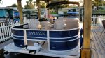
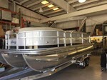
2016 20 foot Sylvan RPT (V Pontoons)
Yamaha Vmax SHO 115HP
80 Pound Thrust RipTide Trolling Motor
Humminbird Helix 7 Side Imaging
Yamaha Vmax SHO 115HP
80 Pound Thrust RipTide Trolling Motor
Humminbird Helix 7 Side Imaging
-
FLOUNDERPOUNDER225
- Posts: 314
- Joined: Thu Jul 16, 2015 7:19 am
Re: GPS / Fishfinder
Friar, here is a listing from our Pensacola fishing forum: a little above your price range as stated, but he might be negotiable just passing it on BC I saw you were looking at Lowrance
http://www.pensacolafishingforum.com/f5 ... cs-796169/
http://www.pensacolafishingforum.com/f5 ... cs-796169/
Pensacola FL
2015 Berkshire 231 RFC
Yamaha F-150
2015 Berkshire 231 RFC
Yamaha F-150
Re: GPS / Fishfinder
[quote="joe20toon"]After looking around at different makes and models, I decided on the Humminbird Helix 7. Mine has "Side Imaging" to scan up to 150 feet left and right, as well as the regular down scan imaging. Humminbird GPS mapping (Lakemaster) allows you to select a region - Southeast, etc. or, pick and choose what lake or chain of lakes you need. Humminbird Helix has several sizes to choose from. I thought the Helix 5 was too small on screen size, the Helix 10 was too large on 'price size.' The Helix 7 fit right for me.
I've looked into two main GPS mapping 'programs' Lakemaster and Navioncs.
Lakemaster allows you to select a particular depth or range of depths using the Depth Highlight feature to keep you in the strike zone. Use Shallow Water Highlight to help identify hazardous areas or shallow fishing water. Water Level Offset lets you adjust the chart to the current water level.
I don't think 'water level offset,' depth highlighting and shallow water color coded highlighting is offered by Navionics. Water level offset is great for those that have varying lake levels, whether it's a dam, flood control, etc..
In my comparison of Navionics with Lakemaster, I found Lakemaster has much more detail and more water area surveyed than Navionics. For example, Harris Chain of Lakes in central Florida has many residential canals and an area called Dead River that connects Lake Harris with Lake Eustis. Navionics didn't survey these areas at all. Lakemaster provided excellent bottom contours of this chain and even the smaller residential canals.[/quote]
Depth adjustment and shading is offered on navionics.
My vote would be for the raymarine wifish unit(same sonar as the dragonfly pro mentioned above but with no display), 10 inch tablet, and navionics app, and some sort of mount (we used industrial hook and loop fasteners so it looks flush mount). This whole setup would cost you less than 400 and would give you a 10 inch touch screen fish finder. I recommend the Insignia brand tablet from best buy as it is cheap, you can see it in either orientation with polarized sunglasses on and some tablets you an only see in portrait or landscape with sunglasses on, and it runs the setup well.
This rig gives you updated charts for $5 a year as well which is cheaper than buying the chips, it updates the charts using your sonar data, you can have multiple displays on the same boat a lot cheaper, and it's cheap to upgrade/replace the display, it does automatic routing for fastest route and will calculate estimated time and fuel burn if you input your cruise speed and fuel burn at that speed, etc.
It will also update your charts from other users in your area that use the sonarchart live feature so you will get a real view of the bottom the more people that use it. It solves the issue of the quoted poster with some areas not be mapped. If you really wanted to you could but a second transducer and use it on another boat or in a small boat in ponds to create sonar maps of those.